


Presented by Garmin Quickdraw™ Contours
In a 2019 article, Pete Bowman gave us some exclusive insights into his and Ang’s trip to Algoma and laid out the reasons why anglers should always map an uncharted lake before fishing it. Today, we’re going to do something a bit different and walk you through some of the top reasons to chart the lakes that already have already been mapped.
How To Chart a Lake using Garmin Quickdraw™ Contours
Before we get to the why, we must first start with the how. As Pete laid out in his article a few years ago, Quickdraw can completely transform the details your fishfinder can give you and can turn an intimidating body of water into something much more inviting. The screenshot below paints a perfect picture of what a once-barren area can look like after a little bit of charting
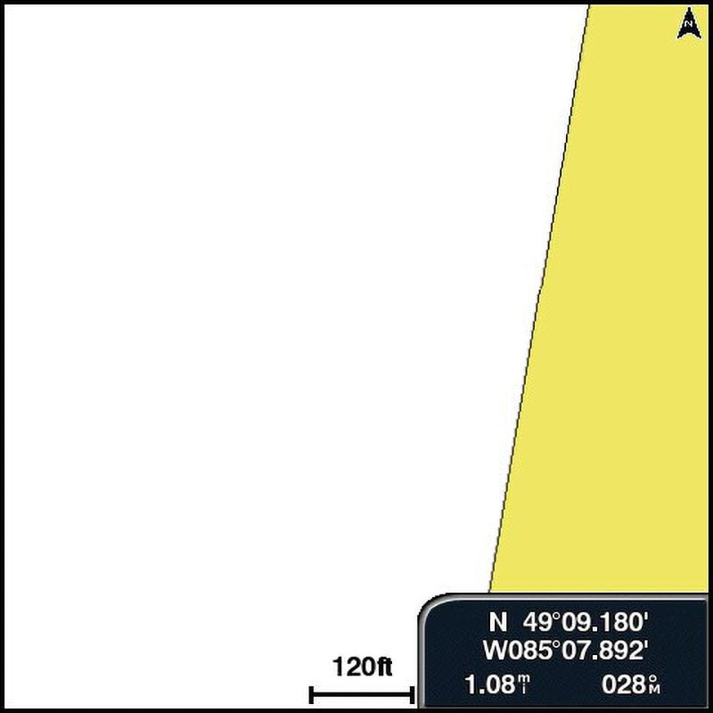
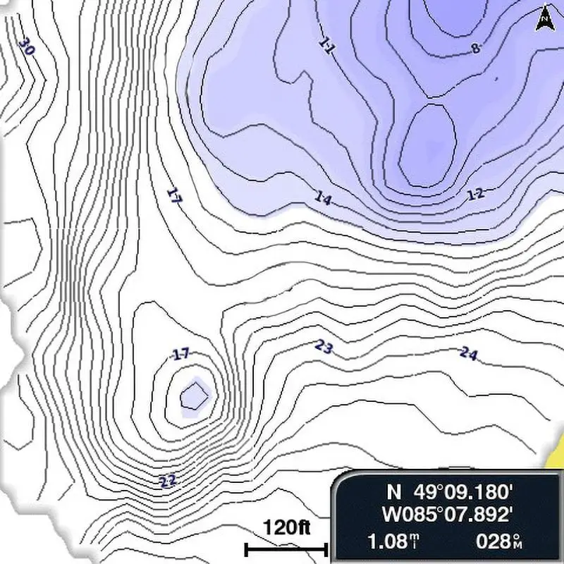
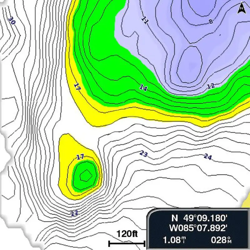
As you can see in the screenshots, the map of the uncharted Buck Lake started as… well, just that – a blank, uncharted map. After turning on the Quickdraw feature of their Garmin EchoMAP DV, however, the map now showed every hump, ledge, and finger in the area with detailed 1-foot contours. Finally, the boys put the finishing touches on their new map by colour-shading the areas that they wanted to concentrate on. On this particular trip, these were humps and saddles at the depths of around 16 to 18 feet.
Here is an excerpt from Pete’s original article on how they did it:
“On the chart page, do the following (make sure you have an SD card inserted to store your recordings):
With the Charts (GPS) screen on:
For Quickdraw – MENU > Quickdraw Contours > Start Recording (Display On)
For Colour Shading – MENU > Chart Setup > Chart Appearance > Depth Shading > New Depth Range > Shading On > Colour (Choose whatever you like) > Lower Depth (preferred lowest depth number) > Upper Depth (preferred highest depth number). Then keep hitting Back until you return to your new psychedelic chart.”
Why You Should be Mapping Charted Lakes
Now that we know how to map, it is time to talk about why you should consider doing it for lakes that are already charted. Here are a few of the reasons we run Quickdraw on charted lakes:
Finding Hidden Structure
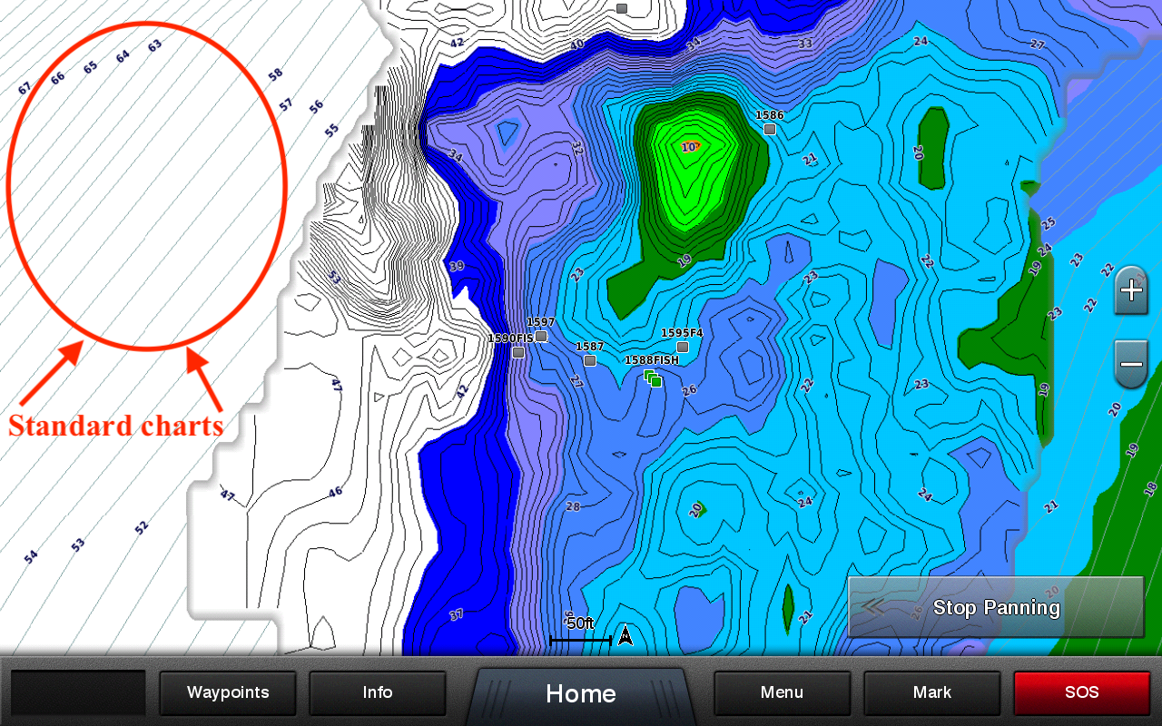
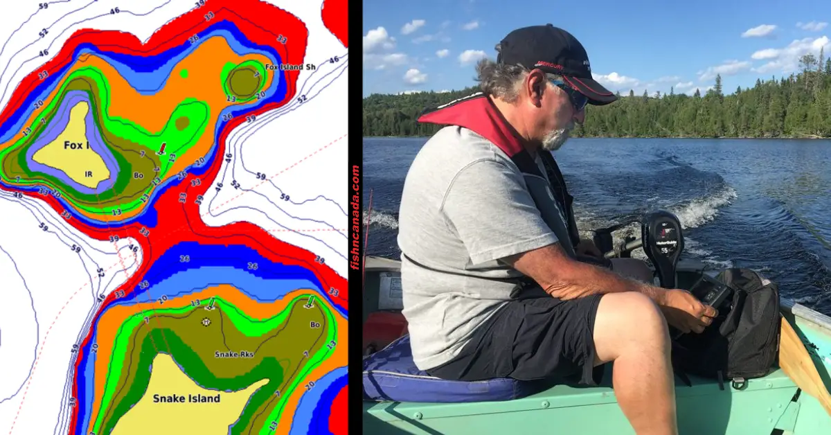
Finding structure is essential to finding fish, especially on lakes you are not familiar with. As you can see in the screenshot above, while on Borden Lake near Chapleau, much of the structure that was needed to find fish on this trip was simply not visible on the standard charts. Just a little bit of mapping with Quickdraw, however, and humps began appearing, straight contours tuned into saddles, and areas that once looked like steady declines revealed themselves to be steep ledges.
This ability to reveal structure makes all the difference when fishing unknown lakes, but can also be especially beneficial on lakes that receive a lot of pressure. Since most anglers are working with the standard charts seen on the left side of the screenshot, the majority of the boats hitting the water will be focused around only the most obvious pieces of structure. This leaves the table-top-sized humps and the small, steep ledges that fish so often cling to reserved for those taking advantage of the mapping features on their sonar.
Keying in on a Pattern
As we could see in the previous screenshot, the boys were not only able to see the structure that was hidden by the standard charts, they were also able to colour-code the area they were fishing.
In addition to providing some psychedelic patterns to the otherwise plain-looking map, this colour-coding allows anglers to focus in on key pieces of structure by showing desired depths in whatever colour the user chooses. If the walleye have only been biting on those 22-foot humps, just set that depth to the colour of your choosing and watch the screen light up with the most productive spots in your area.
This is also an excellent feature for those who aren’t able to pay constant attention to their fishfinder. Fish’n Canada’s editor, Dean Taylor, had this to say:
“I, personally, got lots of use out of this while I was guiding in northern Ontario as we are expected to tie knots for guests, control the boat, and net fish all while keeping the boat in productive water. This is a near-impossible task when trying to stay on hard-to-see humps on the traditional white screen. With colour-coding, on the other hand, I just make sure the boat is still surrounded by my selected colour and I know we’re good!”

Keeping Up With Changing Conditions
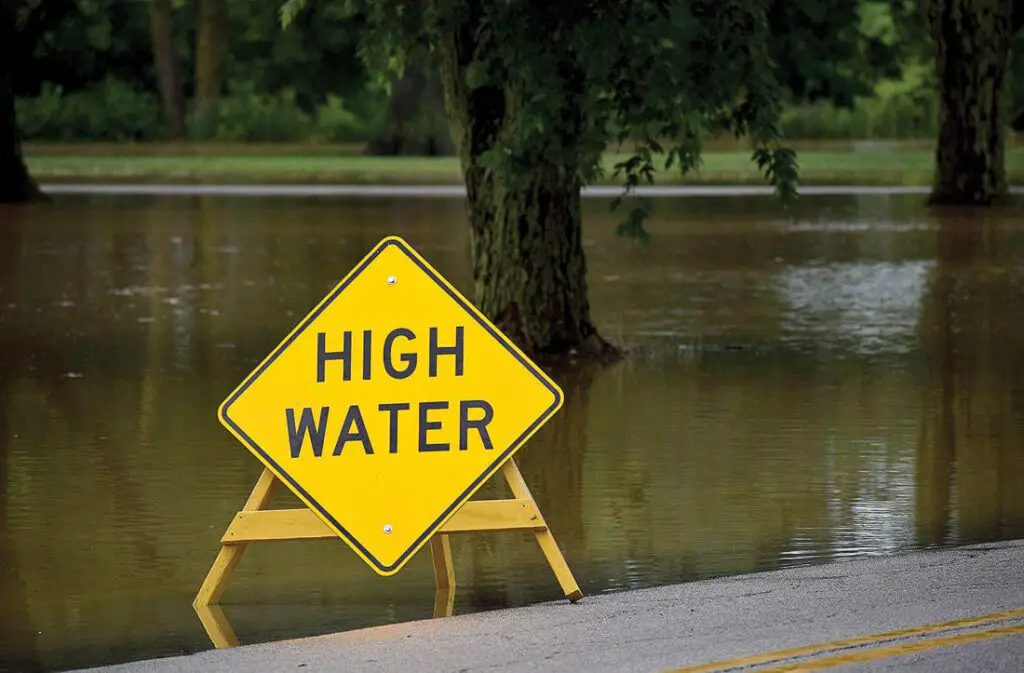
Water conditions have been everything but stable in the last decade or so. The Great Lakes might be the perfect example of this as, just two years ago, docks were floating down the lake due to high water in the exact same areas that are now so dry we can’t launch our boats.
As many have likely noticed, these constant changes in water levels make standard charts less reliable than ever. On low water years, what were once shoals are now islands and, on high water years, small islands become fishable bass flats. To combat these changing conditions, we prefer to rely on our own maps and use QuickDraw to make them. Just cruise around the area for a few minutes before fishing, review the map you just made, and fish the area with confidence.
Pete & Ang offer a word of caution, however. When it comes to re-mapping areas using QuickDraw, never do it during low or high water events. Mapping new areas for “same-day-fishing” is fine, but when “filling in the gaps” of previously created Quickdraw maps, try to stick to late spring/summer when water levels are stable. This will avoid having maps be inconsistent and missing key features that are only exposed/submerged when water levels are at their extremes.
Prepping for Ice Season
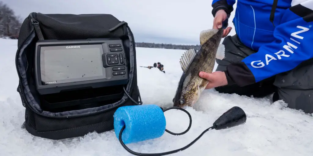
This is perhaps our favourite reason to chart lakes. Finding productive ice fishing spots is hard enough as it is, especially for someone without a sled. In this case, every spot you want to fish requires a hike, a freshly drilled hole, and another setup of your hut and heater.
To spare yourself as much of this hassle as possible, we always recommend charting the lakes you are going to target through the ice well before the season starts. This way, you can use the mobility of your boat to scan the lake and highlight the spots that you think will be most productive when the season starts. Planning for a January Lake Trout trip? Mark those deep humps and saddles in November and save yourself all the hut packing and hole hopping when things finally freeze over.
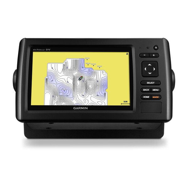
The key to this technique is, of course, an ice kit for your fishfinder. Garmin sells these bundles on their website but you can also find them sold, rather affordably, at any retailer that sells Garmin fishing products.
Conclusion
In summary, don’t assume that traditional charts are telling you everything the lake has to offer. Get out on the water, do some exploring, and see for yourself what is really going on beneath the surface!
