


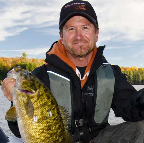
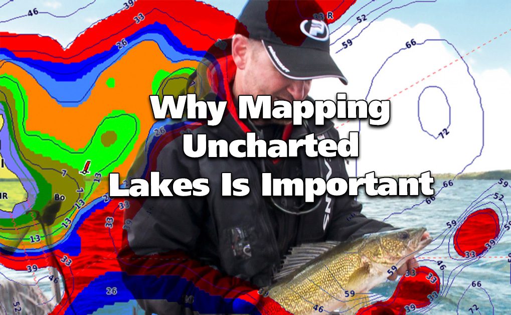
On a past trip to Ontario’s Algoma Region, Ang and I had a chance to really dig into one of Garmin’s extremely valuable features in the chartplotter/fishfinder world. This feature is called Quickdraw.
THE LAKE
We were based out of Buck Lake Wilderness Lodges and Outposts.
Buck Lake (Lake Obakamiga) is a typical Ontario Walleye/Pike lake. But, like so many, it’s an uncharted lake. Essentially, there is nothing as far as detailed contours or depths on any of the base maps we could find (including our Garmin mapping)—just a crude (and ultimately inaccurate) outline of the lake.
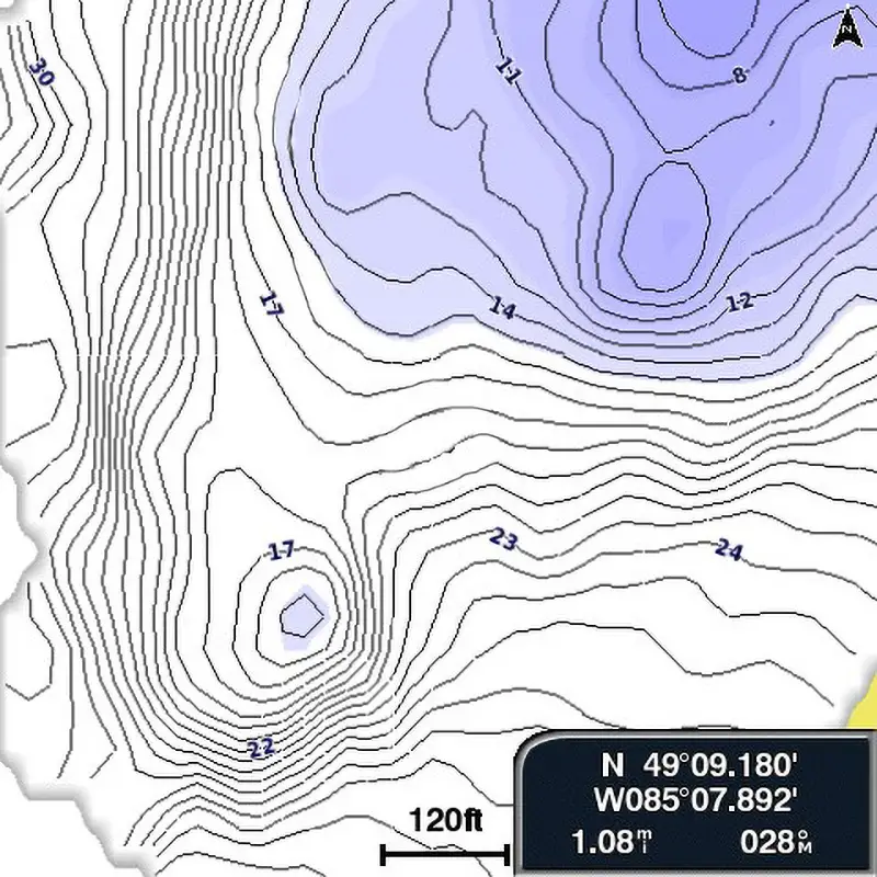
Here is what Ang and I did to put the odds in our favour: Once we found an area we wanted to fish with our traditional sonar screen (a long, extending underwater point in this case), we turned on the Quickdraw feature of our EchoMap portable unit and started to record the area’s bottom contours. Mapping an uncharted lake is something you should consider if you are running a compatible Garmin unit. And it becomes super important on a fly-in trip where little knowledge of the lake bottom is thoroughly documented.
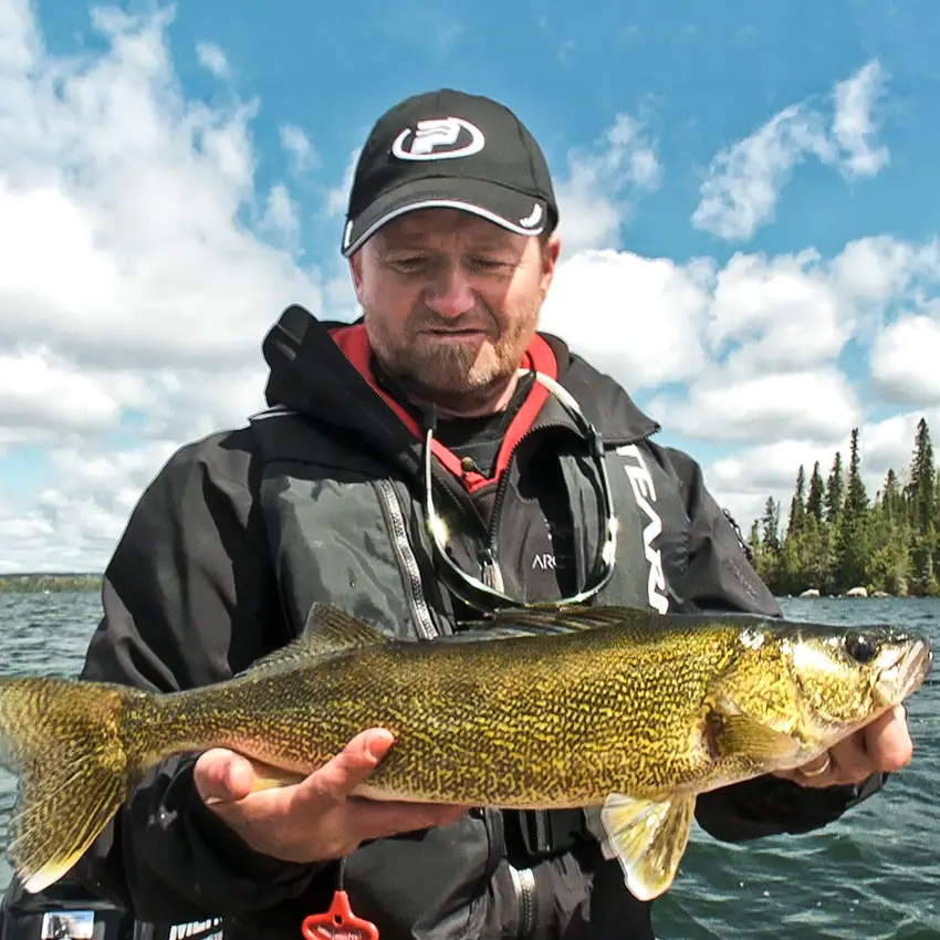
THE WALLEYE
We found our Walleye in around 16 feet of water. The surrounding deeper water had very few fish, and shallower water (especially in the 12-foot area) was loaded with jig-stealing Pike. In fact, during our first evening of fishing, Ang made three drops with his jig in the 12-foot range and was instantly bit off by Northerns—two of which we would have really liked to see, as they doubled his rod over!
After several low-speed boat passes in and near our newly desired depth (along with a few controlled drifts), we’d created all-new charts, giving us a fantastic, detailed, and accurate map.
Next came a simple colour shading (we chose yellow for easy visibility) in the 16- to 18-foot range. Then suddenly our fishing grounds were literally lit up on the Garmin screen. By staying in the yellow zone, Ang and I not only boated Walleye after Walleye, but we avoided the forbidden snake pit of vicious, veracious hammer-handles!
THE TECHY STUFF
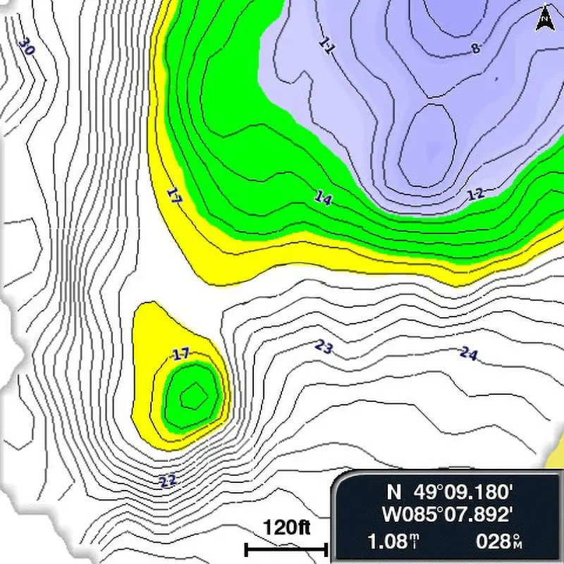
Here we have colour-shaded the areas we would like to concentrate on. The yellow represents our desired depth of approximately 16-18 feet, but we did find Walleye a bit shallower. Thus, we put in a second colour (green) so we could veer slightly into that zone as well.
If you have a Garmin with these features, it’s quite easy to do. On the chart page, do the following (make sure you have an SD card inserted to store your recordings):
With the Charts (GPS) screen on:
For Quickdraw – MENU > Quickdraw Contours > Start Recording (Display On)
For Colour Shading – MENU > Chart Setup > Chart Appearance > Depth Shading > New Depth Range > Shading On > Colour (Choose whatever you like) > Lower Depth (preferred lowest depth number) > Upper Depth (preferred highest depth number). Then keep hitting Back until you return to your new psychedelic chart.
PUTTING IT ALL TOGETHER
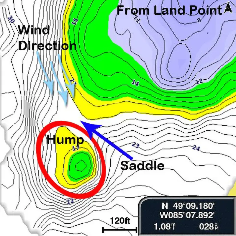
The blue is the shallow water extending under the surface from the point and is set separately from all the other settings (on the chart screen, menu > layers > water > shallow shading and then you type in your desired number on manual mode). You can turn this feature off as well if you like.
The green is our inner edge or boundary if you will—too far into the green zone and it was Pike galore.
The Yellow was Walleye Country on this trip.
Notice the hump at the end of the point along with the saddle in between. On the green crest of the hump there were both Pike and Walleye.
It would have been very difficult to locate and fish all of this point properly had we not had these charting features. We would set up somewhere around the blue arrows and use the wind to carry us over the point. For ultimate boat control, we would use our chart to guide us and simply bump the Merc in forward or reverse, correcting our path.
Almost every Walleye we caught hit in or near the yellow zone. Amazing technology, eh? It really goes to show how much help mapping an uncharted lake can be.
Next time you are out on the water and you find fish at a particular depth, take a bit of time, recreate and refine the area’s maps with Quickdraw, and then try colouring in your charts to that particular “perfect” depth—it makes life so easy!