


Originally seen in Fish’n Canada’s Week in Review
Numerous articles have been written (including here at Fish’n Canada) about the devastation caused by the BC floods, but recent satellite images may just put the whole thing into perspective.

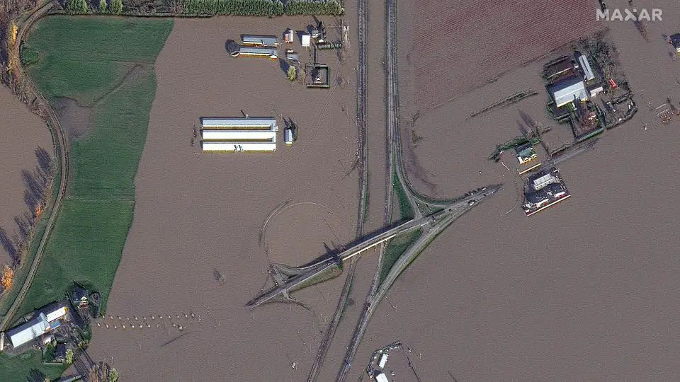
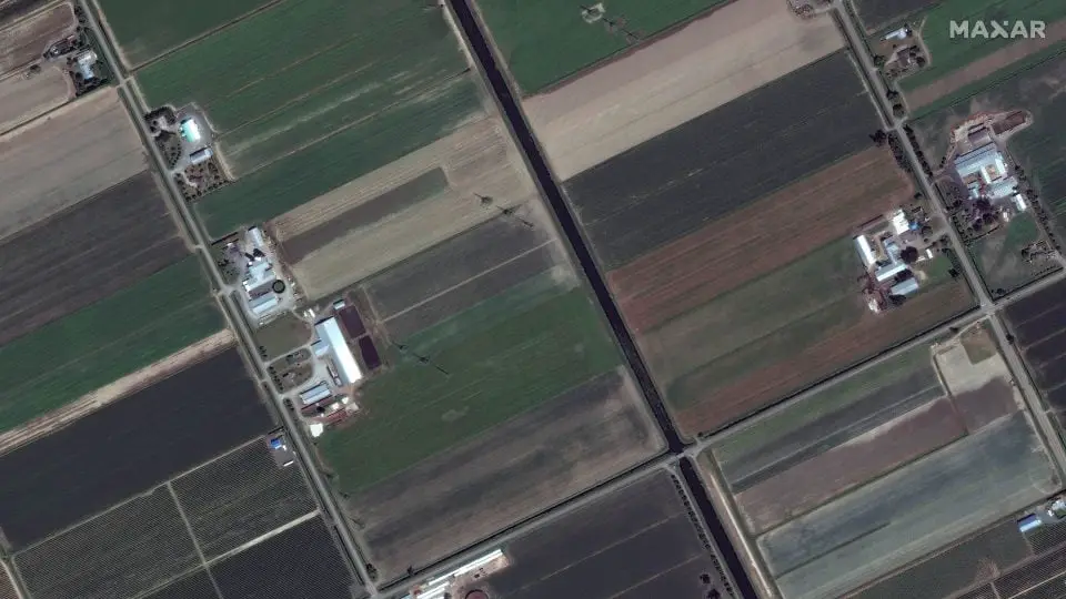
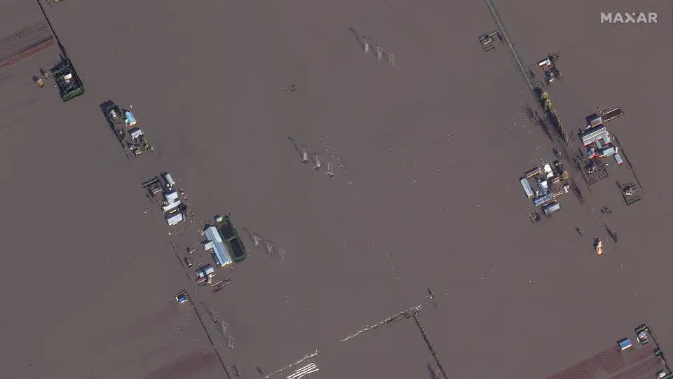
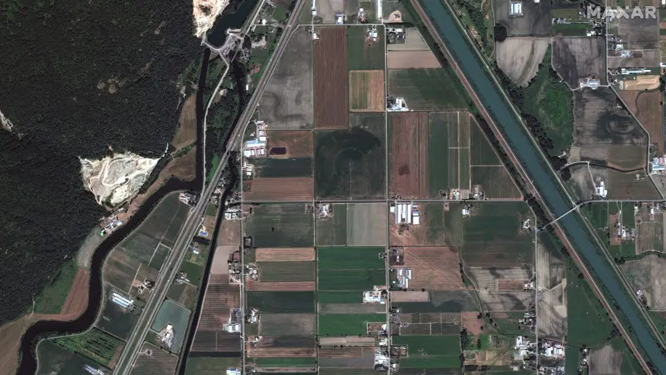

The images above, produced by a company called Maxar Technologies, show the damage of the floods in the Sumas Prairie, part of the Fraser Lowland. Many of these areas have been evacuated as potable water is limited and mass amounts continue to run through the area.
As we covered last week, our fishing guide friends in the area have been busy running jet boats to deliver supplies to those in areas where road access has been eliminated by the floods. The full story can be found at the link below, as well as some ways that you can help our friends in BC get back on their feet.
This excerpt was taken from Fish’n Canada’s Week in Review, our weekly recap of all things relevant to the Canadian outdoorsman. For more stories like this, check out the full article below and tune back in every Friday to catch up on everything you missed!