


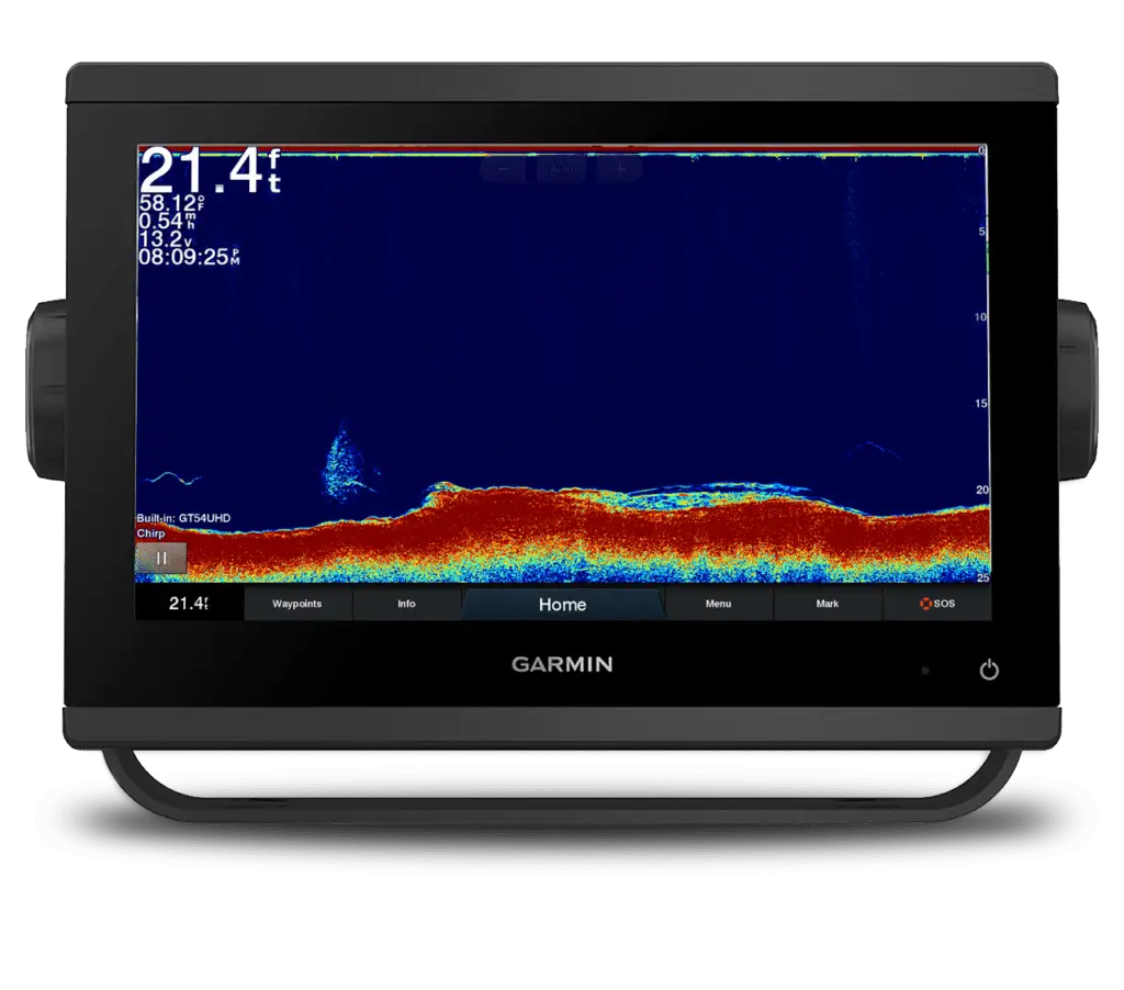
Presented by Garmin
As those who have been following along on our Instagram can surely attest, we here at Fish’n Canada love our screenshots.
This is not just because the high-definition screens of our Garmin units are so nice to look at, but because they are a great learning tool.
Countless times have we returned from the lake to look at some of the screenshots we took out on the water to see fish, bait, and structure that we missed during the many distractions of the day. So, to show you some of the things we have come across during these post-fishing breakdowns, we have compiled 10 of our most informative screenshots and a brief analysis of what we learned.
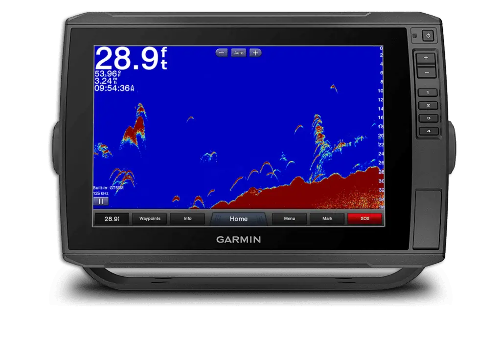
1 – Side-Vu Muskie
Analysis:
This is a Muskie (we know that because there are no Pike in the lake we were on) suspended up off the bottom on our EchoMap Ultra 126sv. The fish was almost directly under the boat (in the dark area on side viewing screens) and the dark line to the right side of the fish is its shadow. The distance between the mark of the fish to the mark of the shadow signifies the fish is suspended. Had they been closer together, it would have meant that the fish was closer to the bottom.
It’s interesting to note that the shadow (at least to us) looks more like a fish than the actual fish does. Always study solid objects as well as the shadows they leave.
2 – Grassy Hump
Analysis:
Here’s a great screen grab from an EchoMap unit showing a distinct hump surrounded by deep water.
As you can see, this great piece of structure has significant weed growth on the top (around 10 feet deep), making it an ideal area to investigate for a multitude of species. Fish like Walleye, Smallmouth Bass, Muskie, and Pike would be normal visitors to this kind of spot. Trout like Rainbow would also be attracted here. Late season Largemouth “might” be found here, depending on the structure’s location.
Note the crosshairs in the shot. By pausing the unit (lower left pause & play button), we can then drag a finger across the screen and place that cursor anywhere we like. Remember that the waypoint’s most basic information is long and lat with depth being secondary. We simply drag the crossing point to the middle of the structure and then hit the top right “add waypoint” button. This gives us a waypoint directly in the middle (or close enough to it) of the area we’re marking.
NOTE: Screenshots such as this one don’t necessarily signify a round “hump”. It’s simply a rise in the bottom and could be a long tapering point, so scanning the entire area is a must to identify all structure and cover.
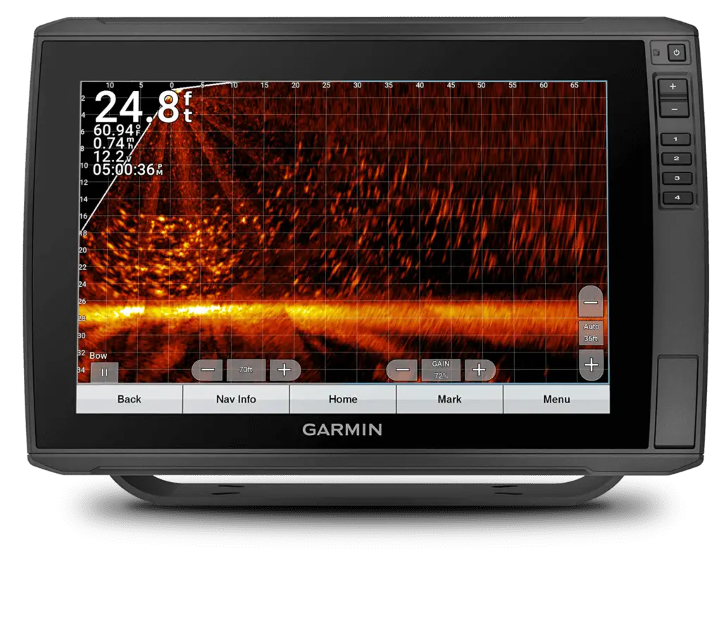
3 – School of Sheepshead
Analysis:
“We feel that a lot of the arches or hooks on this traditional screen were indeed Sheephead. There were that many fish in the area. However, that stack of arches for instance, is probably some kind of baitfish.”
“Those big, thick, juicy, arches to the left were probably a couple of the giant Sheephead (there’s fish up to 20+ lbs in that area) cruising high off the bottom.

4 – Split Screen
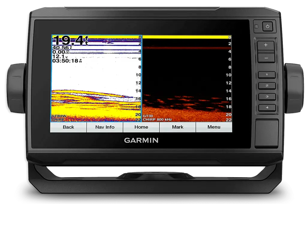
Analysis:
Here’s a screenshot that has a couple of things going on. Although there are anglers out there that try to avoid technology and “numbers” etc. (they just want to fish & we get that), to truly enjoy the fishing with electronics experience, we love digging deep.
The first thing that’s going on is if you notice there’s a blue-coloured outline around the left side on the traditional screen. This blue line indicates that the traditional side is active. What that means is, when you hit a function like a zoom key, you will be working (zooming in this case) on that traditional side. You need to physically change the screens back and forth to work on them (could be up to 4 screens).
The second thing happening here is, if you notice the numbers after the GT on each screen, they’re different. This setup came from a fibreglass boat in where there was a puck style transducer as well as a Side-Vu/Clear-Vu transducer. This setup runs both simultaneously via a Y cable which splits the signal.
The puck transducer (GT8HW) shoots a signal directly through the bottom of the boat’s fibreglass hull which gives anglers (and boaters) a great reading on their traditional screen at high speeds. Many tournament boats run one of these for their on-plane running.
The Side/Clear transducer (GT30 in this installation) is normally mounted externally off the transom (or under a jack plate), creating a nice clean signal to be sent out while scouting at lower speeds.
5 – Panoptix 3-Pack
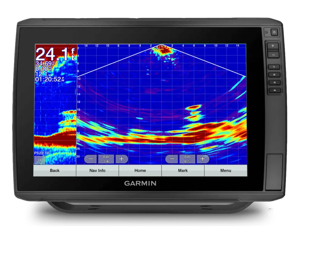
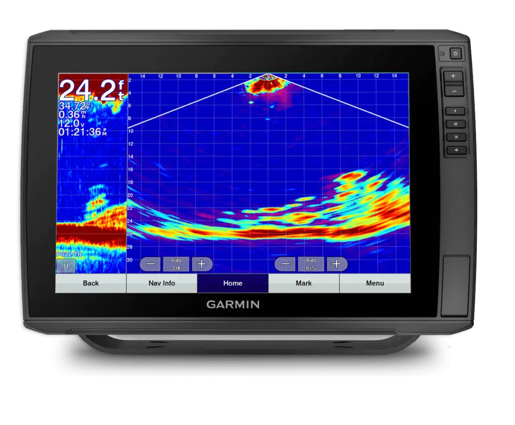
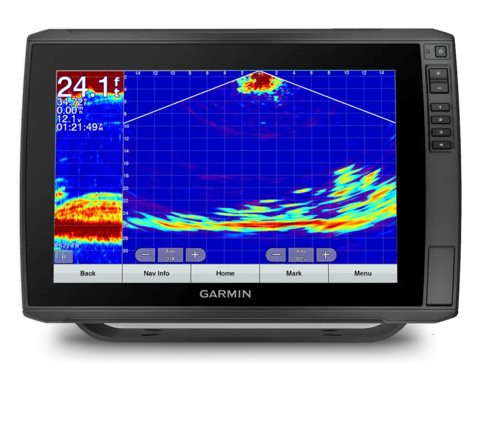
Analysis:
When Panoptix LiveScope came along, it turned the fishing world upside down. People were going crazy just trying to see internet footage of this latest and greatest phenomenon.
What many don’t or didn’t realize though, LiveScope is an offspring of the original Panoptix Forward and down. Garmin’s PS21 and PS22 transducers shot out a strong signal and when interpreted correctly, showed real-time fish swimming (like LiveScope).
These 3 shots are from a PS22 set to the Down position from the transom of the boat. We still use this transducer along with the ultra-powerful PS30 in certain instances. They are excellent for deep water situations.
This is a school of Crappies, Perch and Sunfish (we know because we caught all 3 of them) that were stuck close to the bottom.
The Panoptix technology certainly has changed fishing!
6 – Breakline
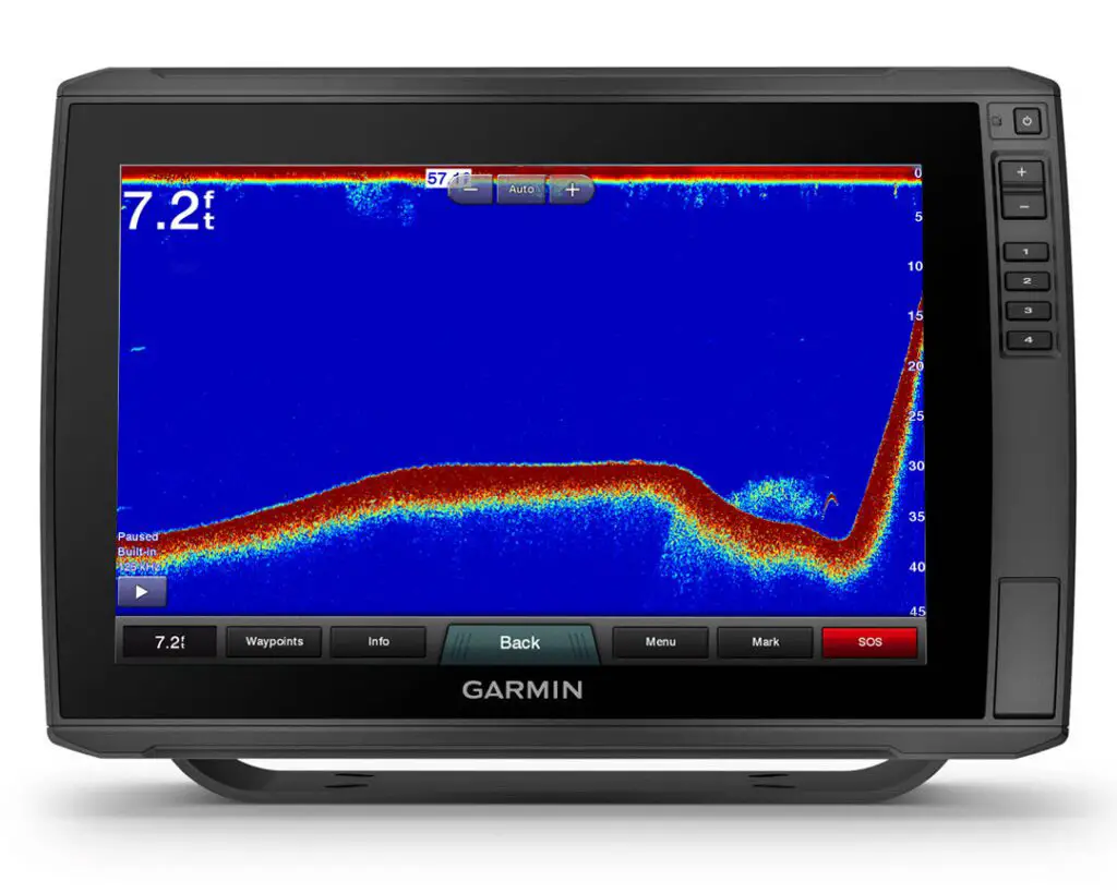
Analysis:
Here’s a nice clean screenshot of a single fish on the traditional mode screen. Notice how well-defined and crisp this fish is even though it is sitting in a somewhat protected area. As well, check out the cluster of bait sitting right next to the fish and set up on the smaller, secondary break.
7 – LiveScope Perch
Analysis:
Here’s a Panoptix LiveScope screenshot that should clearly tell you that, there are times when fishing, that anglers are amazed at what’s going on under the boat.
In this case, the fish here are grouped in a massive school of Perch in the early fall period of the calendar. We are not sure if they stay like this all year long as we only get to this lake on occasion.
“The problem here,” says Ang, “is there’s simply too much bait to effectively fish species like Walleye or Smallmouth. If you can locate the bigger fish, why in the world would they take our little presentations? We normally look for smaller bunches of bait with single fish, and all the way up to a school of predators”.
8 – Weeds on SideVu
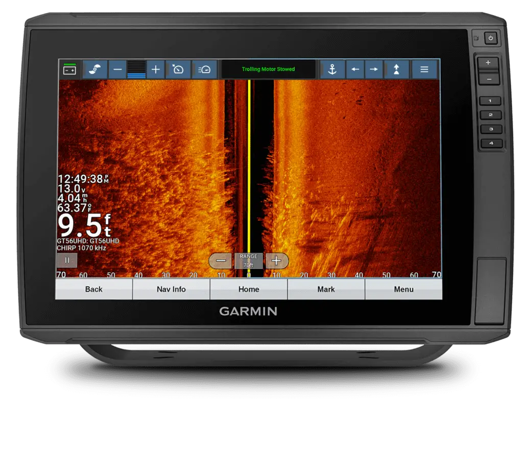
Anlaysis:
With the clarity of imagery picked up by today’s sophisticated transducers and then displayed on Ultra High Definition screens, understanding these great fishing aids is getting easier and easier.
No surprises on this one. What we wanted to concentrate on here is the big weedbed and weedline (amongst a few other objects and possible fish in the upper right).
“On the left side of the screen” says Ang “is the most prominent or thickest part of the weed bed. Notice how the weeds in the black portion of the screen show even more detail than over the coloured portion. That is simply because of contrast which, incidentally, you need to use to your advantage. Something else that shouts out HEY LOOK AT ME is the definitive weedline in where the weeds stop and the flat, smooth bottom continues”.
“Right here and now” continues Pete, “you are looking at a static, still image on your phone, tablet or computer. In the field, you will normally be looking at a moving image on your fishfinder which is often harder to interpret. That is why pausing the scroll and or taking a screenshot for later viewing is imperative throughout a day on the water”.
As well you will notice the data bar across the top of the screen. This is the connectivity of our Garmin Force trolling motor teaming up with our chartplotter unit. By having this bar across the screen, now we can control the trolling motor by touching the screen(s), along with the hand remote as well as the foot control pedal. That’s 3 ways to control our rig… ingenious!
9 – Fish Locked on Bottom
Analysis:
When you come along an instance like this while out Walleye, Smallmouth, maybe Pike… heck pretty much anything, you need to STOP, DROP AND ROLL. This screenshot on a GPS Map traditional screen, is what we here at Fish’n Canada pretty much dream of… especially when we’re Walleye fishing.
If we are slowly scouting the area and see this, we stop and drop. If we are trolling an area and see this, we instantly drop a waypoint and either finish our trolling pass (quickly), or quickly reel in and grab the spinning rigs to dissect the area.
“To us,” says Pete @petebowman_fishing “these are hopefully our intended quarry locked to the bottom. Sometimes marks like this fool us and aren’t fish BUT sometimes they are. Small groups of Walleye will occasionally do this. They aren’t hanging around any specific bait-ball nor are they relating to a textbook piece of structure or cover. These fish are on a flat bottom and will often bite.”
“Drop down some kind of jig” Ang continues “or, if you’re a DS nut like me, sink a Drop Shot rig among that mess of marks and hang on. And the beauty of this situation is, you may get lucky and catch a few!”
10 – Mystery Marking
Analysis:
So, here’s a screengrab that we took in the field, paused the screen to see what the heck it could be, took it back to Fish’n Canada Central to view it on a computer screen and still had us in bewilderment.
The lake bottom in this area has a good amount of mud and clay which is very porous and knowing that, we figured it might be bubbles flowing up.
We also thought it “may” be a crazy school of bait but why would they be swimming in that weird-looking formation? Are they migrating? Did their leader suddenly make a right turn towards that hard bottom area?
With such an odd-looking shape under the lake’s surface, we absolutely NEEDED to know what this image represented.
The folks at Garmin gave us a great suggestion and we believe them.
It is the cavitation bubbles created by our propeller on our Mercury. By turning circles while running our SideVu, we were actually going back over our previously “motored” area and picking up the bubble trail we left behind. How’s that for sensitivity? The GT 36 and 56 transducers are amazingly accurate.
Want more screenshots? Follow us on Facebook on Instagram for a new screenshot and analysis every weekend!


One Response
Nice picture very clear